

Vietnam is a country with a tropical monsoon climate with an average annual rainfall of more than 3000mm. Along with that, Vietnam is also located in a strategic location and has a shape stretching over 1000km. Therefore, many advantages have been created in the formation of more than 2,360 rivers and canals stretching across Vietnam. With such a large number of rivers, what are the 10 longest rivers in Vietnam? Let’s explore with toplist.com.co through the article below.
The Mekong: Vietnam’s Longest River and a Global Legend
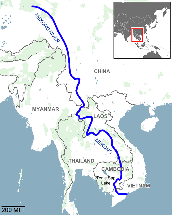
Far more than just Vietnam’s longest river, the Mekong is a storied waterway that etches its way through the tapestry of global geography. Join us at toplist.com.co as we embark on an exploration of this river’s mystical journey. Originating from the remote highlands of the Tibetan Plateau in China, specifically the Qinghai province, the river weaves its way through several countries including China, Laos, Myanmar, Thailand, Cambodia, before finally surrendering its waters to the South China Sea in Vietnam. Spanning an impressive 4,350 kilometers, the Mekong River proudly claims the twelfth spot among the world’s longest rivers. In terms of water volume, it ranks tenth, with an average discharge of 13,200 cubic meters per second, which can surge to 30,000 cubic meters per second during the flood season.
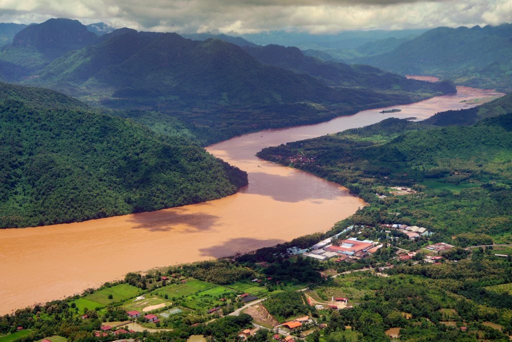
Upon reaching Phnom Penh, the Mekong River gracefully divides into two picturesque branches, mirroring the dual paths of life: one is the Bassac River, known as Hau Giang upon entering Vietnam, and the other is the Mekong itself, referred to as Tien Giang or the Tien River in Vietnam. Both branches merge into the fertile Mekong Delta region in Southern Vietnam, each stretching approximately 220 – 250 kilometers, creating a bountiful and lush land.
In Vietnam, the Mekong is affectionately known by several other names such as the Big River and the Mother River, symbolizing a source of life and nourishment not only for the people but also for a rich ecosystem. According to the World Wildlife Fund, the Mekong is home to a fascinating array of species such as the giant catfish, which can weigh over 90 kg and measure more than 1.80 meters, the giant freshwater stingray, and the critically endangered Mekong river dolphin, among others. But that’s not all; the river also harbors rare species like the Siamese carp and the giant barb, making the area a vibrant and appealing hotspot for fishing tourism.
This majestic river is not merely a conduit for water; it is a flowing narrative of life, culture, and enduring spiritual values.
The Red River – A River Intertwined with History
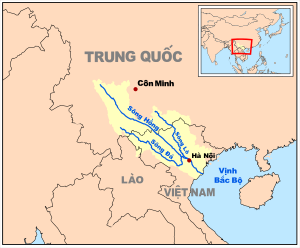
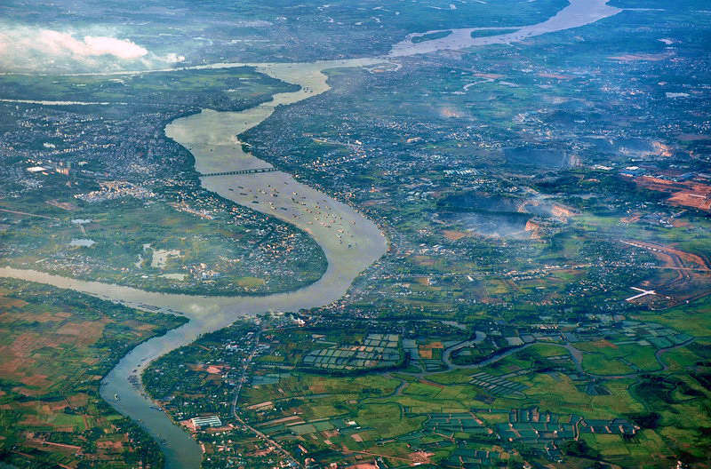
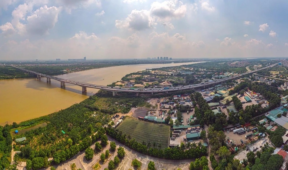
When delving into the rivers that have etched themselves into the history and culture of Vietnam, one cannot overlook the Red River, a river steeped in poetic essence, deeply intertwined with generations of Vietnamese people. With an impressive total length stretching up to 1,149 km, the Red River originates from China, meandering across borders, gracefully flowing towards the East Sea, thereby painting a picture of an affectionate riverine landscape. Particularly, the segment coursing through Vietnam spans 510 km, serving as the backbone, the longest river in northern Vietnam, inspiring and nurturing countless lives.
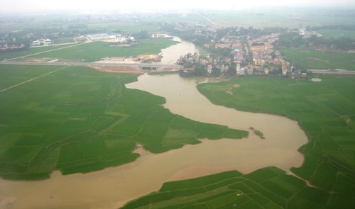
Embarking on its Vietnamese journey from A Mú Sung commune, Bát Xát district, Lào Cai province, where it stands 73 meters above sea level, the river, like a flowing stream of time, winds through Yên Bái, descending to 55 meters, thus forging a magnificent journey through 26 rapids and waterfalls, where rushing waters narrate tales of the robust vitality of this northern river. Approaching Việt Trì, the river’s vigor gradually softens, its pace slowing down significantly, facilitating the fertility of the Red River Delta – the cradle of Vietnamese wet rice civilization.
As the longest river in northern Vietnam, the Red River is not merely the lifeline of the land but also the spirit of the heavens, with an average annual flow of 2,640 m³/s at its mouth, totaling up to 83.5 billion m³ of water flowing through. The flow of the Red River fluctuates with the seasons, from gentle currents in the dry season with a flow of only around 700 m³/s, to majestic torrents in the rainy season, where the flow can soar to as much as 30,000 m³/s, a testament to the richness and diversity of nature.
The Red River, with its blend of grandeur and sentimentality, is not only the pride of the northern people but also an endless source of inspiration for those who have had the privilege to behold and experience it. It stands as the longest river in northern Vietnam, an emblematic symbol deeply ingrained in the historical and cultural flow of the Vietnamese nation.
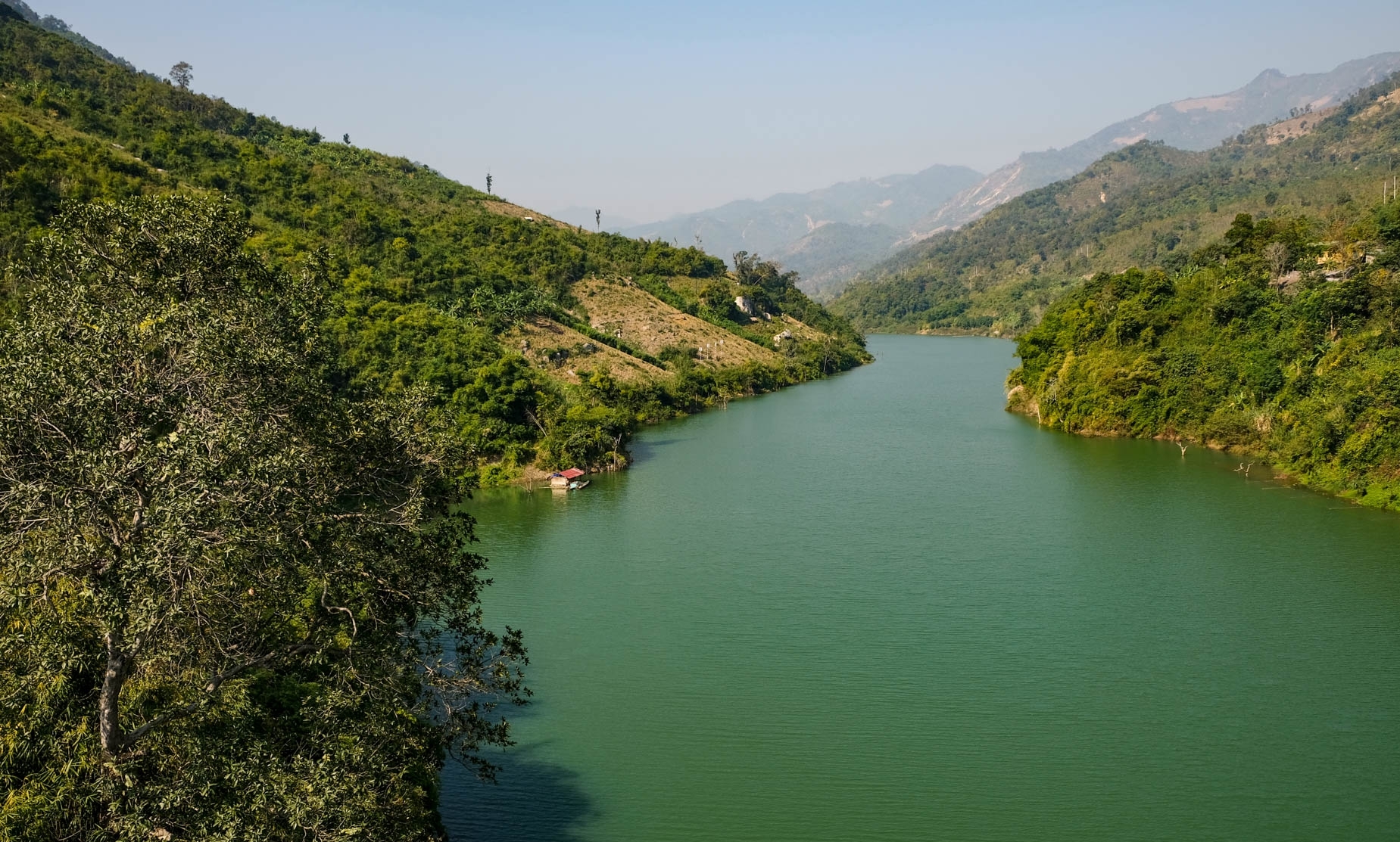
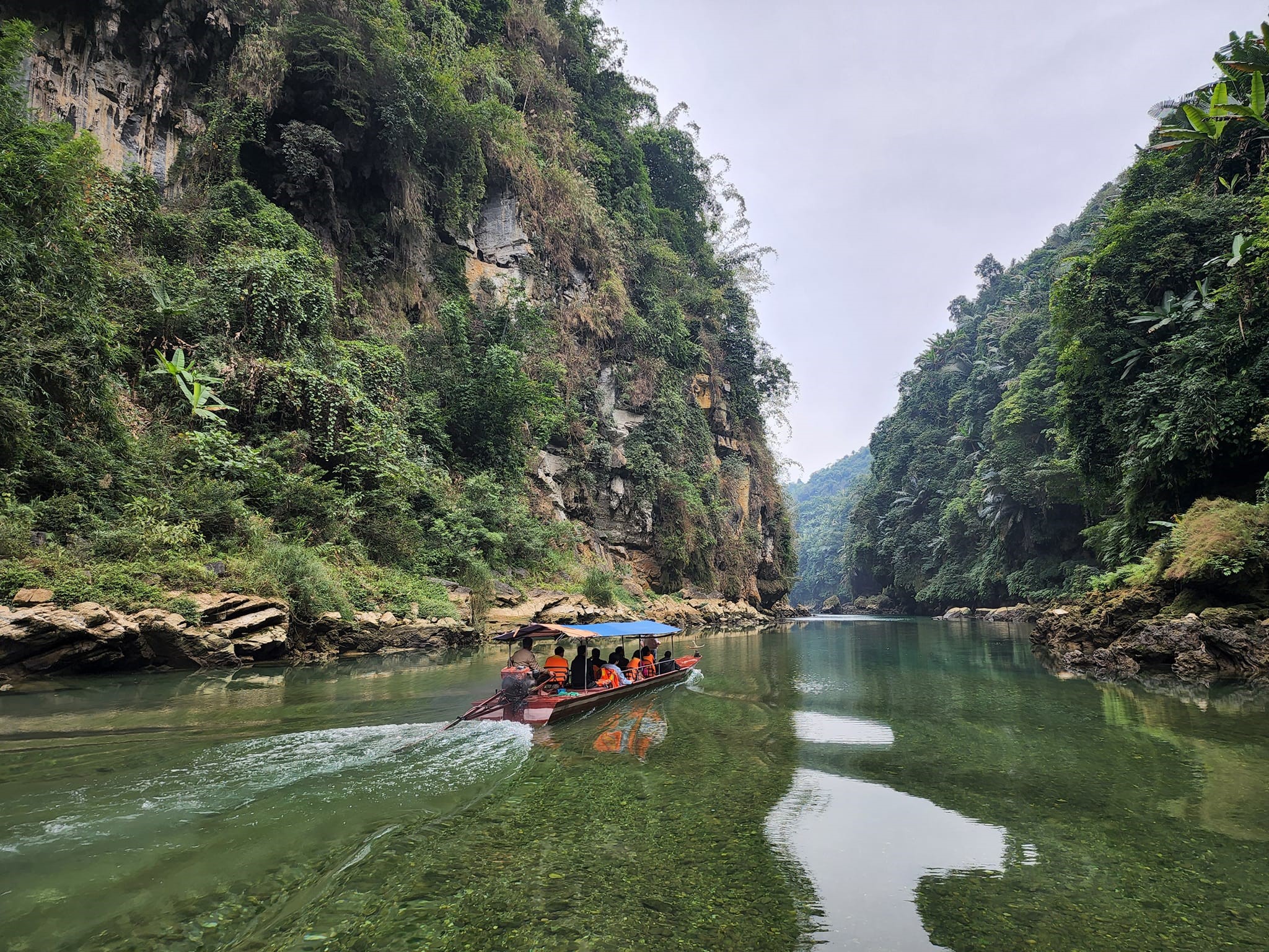
The Majestic Saga of the Đà River
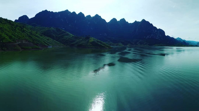
In the relentless pursuit of unraveling the boundless beauty of Vietnam’s rivers, one must pause in awe before the grandeur and splendor of the Đà River – an emblem of pride in the Northwest. Known affectionately by names like Bờ River or Đà Giang, the Đà River stands as the largest tributary of the legendary Red River, boasting an impressive length of 927 km, although some sources may cite figures ranging from 983 km to 910 km.
Emerging from the mystical Vô Lượng Mountain in Yunnan, China, the Đà River meanders northwest to southeast, a potent and proud flow, before merging into the Red River in Phú Thọ. Particularly, along its 527 km journey through Vietnam, from the Vietnam-China border in Mường Tè district (Lai Châu) to the confluence at Hồng Đà intersection, Tam Nông district (Phú Thọ), the Đà River has borne witness to countless historical, cultural shifts, and the development of Northwestern provinces such as Lai Châu, Điện Biên, Sơn La, and Hòa Bình.
In its initial stretch within Vietnamese territory, the Đà River is also known as Nậm Tè, where it runs along the border and meets the tributary Tiểu Hắc at Mù Cá, Mường Tè. The Tiểu Hắc River, with its rugged, majestic, and mysterious beauty, flows westward along the border and eventually converges with the Đà River, creating a magnificent and resplendent natural landscape.
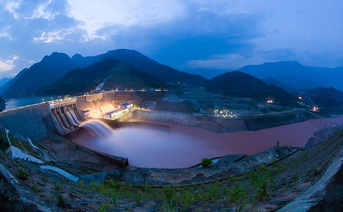
The Đà River is not only one of Vietnam’s rivers with astonishing water flow, contributing up to 31% of the water volume to the Red River, but also a major source of hydroelectric resources for Vietnam’s power industry. The Đà River basin harbors vast potential in natural resources, including various rare minerals, along with distinctive ecosystems comprising rich and diverse biological resources, serving as invaluable treasures of nature.
The Đà River, with its powerful currents and majestic beauty, is not just the pride of the Northwest’s sons and daughters but also a profound symbol of resilience, indomitability, and the enduring beauty of Vietnam’s nature.
The Dong Nai River – Vietnam’s Longest Inland Waterway
The Dong Nai River – a remarkable river not only for being Vietnam’s longest inland waterway but also for its beauty and significance in the lives of millions in the South. Originating from the majestic Langbiang Plateau, the Dong Nai River embarks on an impressive 586km journey, weaving through the heart of Vietnam, enriching the land with its fertile soils.
The Dong Nai River isn’t just a precious water source with a massive flow; it’s also an abundant hydroelectric resource, nurturing numerous hydroelectric projects, including the Dong Nai Hydroelectric Plant. Along its course, the Dong Nai River traverses many provinces and cities, from Lam Dong, Dak Nong, Binh Phuoc, Dong Nai, Binh Duong to Ho Chi Minh City, before finally merging into the East Sea in the Can Gio district, painting a picture of a majestic and splendid riverine landscape.
At its upper reaches, the Dong Nai River is known by the poetic name “Da Dang,” originating from the Lam Vien Plateau, meandering gently through majestic mountain landscapes before pouring into the plains at Ta Lai. The river not only serves as a natural boundary between regions like Dak R’Lap and Bao Lam – Cat Tien, Cat Tien and Bu Dang, Tan Phu and Da Teh but also bears witness to the historical imprints, signifying the development and integration of cultural communities, such as the Hoa community in Cu Lao Pho.
Downstream of the Dong Nai River, where the main stream merges with the Saigon River, it transforms into the Nhà Bè River, also known in ancient texts as “Phuoc Binh.” This area holds significant importance in regulating water flow and serves as a bustling trading hub, connecting the lives of people to the vast ocean.
The Mã River
The Mã River – not just crossing geographical boundaries but also connecting the hearts of two nations, Vietnam and Laos. With an impressive length of 512 km, where 410 km belong to Vietnam and 102 km gently flow through Laos, the Mã River has become a symbol of cultural convergence and friendship between the two countries.
The vast basin of the Mã River, with the majority of its 17,600 km² area lying in Vietnam, is home to diverse biodiversity along with rich cultural communities. With an average elevation of 762 meters, a slope of 17.6%, and a river density of 0.66 km/km², the Mã River basin is a multicolored natural masterpiece, flowing through majestic mountain forests and lush plains.
The Mã River not only supplies fertile silt, shaping the Thanh Hoa Plain – the third largest plain in Vietnam, but also meanders through the valley between the Su Xung Chảo Chai and Pu Sam Sao mountain ranges, creating an impressive and romantic natural scenery.
The journey of the Mã River begins at the confluence of small streams in Mường Lói commune, a border area between Vietnam and Laos, where Bản Pu Lau resides on the mountain, dividing the flow between Nậm Nứa of the Mekong River system and Nậm Ma – the source of the Mã River. This poetic river continues its voyage through Điện Biên Đông, gently flowing through small streams in Háng Lìa, Điện Biên Đông, before returning to the Vietnamese homeland at the Tén Tằn border gate, Mường Lát, Thanh Hoa. The Mã River then meanders through Mường Lát, Quan Hóa, marking a brief stretch through Quan Hóa district as the delicate border between Thanh Hoa and Hoa Binh provinces.
The Lam River
In the grand tapestry of Vietnam’s rivers and waterways, the Lam River, with its poetic aliases like Ngàn Cả, Cả River, Nậm Khan, Thanh Long Giang, proudly holds a vital position in the hearts of the people of North Central Vietnam. Originating from the mystical Xiengkhuang Plateau in Laos, this Vietnamese river in the North Central region paints a powerful and sentimental flow through Nghệ An province before merging with the La River in Hà Tĩnh, forming a meaningful natural boundary between these two provinces and ultimately pouring into the sea at the mouth of Hội.
With a total length of approximately 512 km, of which about 361 km flows through inland Vietnam, the Lam River is not only one of the two largest rivers in North Central Vietnam but also the lifeblood nurturing the cultural and economic livelihood of the region. Covering a vast basin area of 27,200 km², with the majority, 17,730 km², belonging to Vietnam, underscores the irreplaceable position of this river in sustaining life and development in the area.
The diverse terrain characteristics of the Lam River, from rugged stretches with cascading waterfalls from the Vietnam-Laos border to Cửa Rào, to smoother sections downstream, open opportunities for small boats to navigate during the water season, showcasing the resiliency and adaptability to nature of this North Central Vietnamese river. With an impressive total water volume of 21.90 km³ per year, along with an average flow rate of 688 m³/s, it is a priceless resource contributing to the continuous development of the region.
The flood season from June to November, carrying 74-80% of the total water volume throughout the year, poses not only challenges but also opportunities for the locals to harness the potential for agricultural development, hydropower, and tourism. The Lam River, through each stretch of its flow, narrates stories of history, culture, and the resilient spirit of the people of North Central Vietnam.
The Flowing River – Vietnam’s Premier River
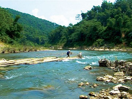
Amidst the myriad of majestic and serene rivers of Vietnam, the Flowing River proudly sits atop the S-shaped land strip, originating from the towering slopes of Tay Con Linh and Kieu Lien Ti, leaving an indelible mark in the hearts of travelers. Spanning 319km, the Flowing River is not merely a cool stream meandering through Northern Vietnam but a symbol of grandeur and strength, traversing Lào Cai and Yên Bái to meet the Lo River in Phú Thọ, like a gesture of peace and amity.
The current of the Flowing River carries within it a complexity and grandeur, with narrow, deep riverbeds alongside towering mountain slopes and magnificent waterfalls. Especially when meandering through Hà Giang, from Vị Xuyên to Hoàng Su Phì, Xín Mần, and through Lào Cai’s Si Ma Cai, the Flowing River resembles a soft silk ribbon, embracing the rugged districts, offering picturesque and splendid natural scenery.
About 5km of this river serves as the natural border between Vietnam and China, creating a space of diverse and rich cultural interaction among various ethnic groups like the Mông, Dao, and Dáy. Moreover, the Flowing River is an ideal destination for eco-tourism enthusiasts, exploring the pristine, simple yet majestic beauty of nature.
During the dry season, when the river is only about 3m deep, travelers can experience the sensation of sitting on a metal boat, upstream along the river to admire the scenery on both banks with simple yet warm houses, gently floating bamboo rafts, and the road to Bắc Hà appearing in the distance, like successive white chalk lines on the mountain slopes.
The Majestic Lô River
The Lô River, a primary tributary of the Red River, originates from China and merges into the Vietnamese land through Hà Giang, Tuyên Quang, and Phú Thọ. Stretching approximately 274 km, the Lô River ranks among the top five longest rivers in the Northern region, embarking on a journey through majestic mountains and lush fertile plains.
This river not only serves as a convenient transportation route for goods but also stands as an indispensable water source for agricultural production and the daily livelihoods of the local people.
The Enigmatic SêrêPôk River
The SêrêPôk River, embarking on a 406-km journey from Đắk Lắk through Đắk Nông, crossing the border into Cambodia before returning to Vietnam. It’s renowned as the river that flows upstream due to its unique characteristic of not flowing directly into the East Sea but rather towards its upper reaches.
This river is not only a vital water source for livelihoods and agricultural production but also a focal point for the development of tourism and hydroelectric power in the region. The SêrêPôk River is also home to numerous majestic waterfalls, among which Dray Nur stands out as a mesmerizing destination, attracting visitors from far and wide to explore its beauty.
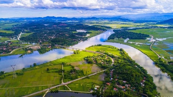
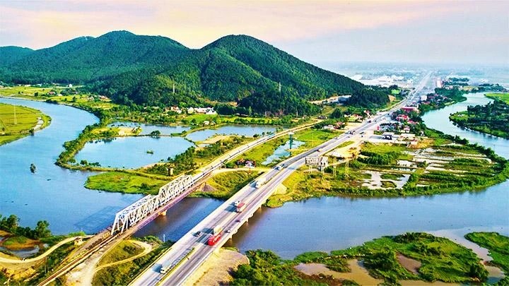
The Majestic Thái Bình River
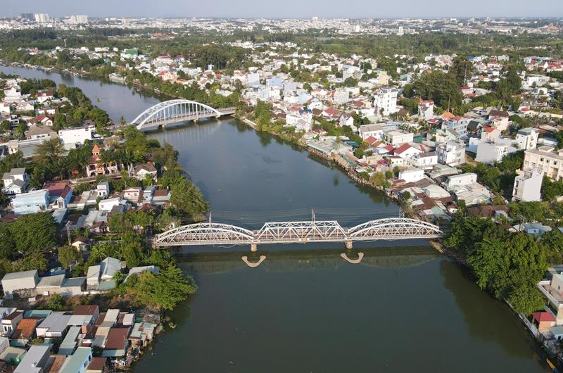
In the flowing tapestry of Vietnamese history and culture, the Thái Bình River is not merely a waterway but also the soul of the Northern region, an inseparable part of Vietnam’s affectionate river landscape. Though it gently meanders through Thái Bình Province, as its name suggests, this river proudly traverses Bắc Giang, Bắc Ninh, Hải Dương, and Hải Phòng, asserting its indispensable position within the Red River Delta’s water system.
The Thái Bình River, also known by traditional names such as the Hàm Giang or Phú Lương River, despite only skirting Thái Bình for about 5 km, holds immense significance. Stretching approximately 100 km, the river serves not only as a precious water source for agriculture and aquaculture but also as a vital transportation artery, fostering cultural connections and tourism development among the Northern provinces.
Known for its robust sediment deposition, the Thái Bình River forms expansive, gently sloping riverbeds and flat bottoms. This is why the river often witnesses flooding, yet each time, it enriches the land with fertile sediment, nurturing the vitality of the Red River Delta.
Across generations, the Thái Bình River has transcended its role as a mere natural feature, deeply imprinting itself on the Northern psyche. It holds myriad tales, from legends to realities, from the past to the future, offering boundless inspiration to those who have stood beside it, gazed upon it, and experienced its essence.
Above is the compilation of the 10 longest rivers in Vietnam gathered by toplist.com.co from various sources. Hopefully, this article has aided you in discovering the most captivating tourist destinations in Vietnam.
Source: Here